Visual Aids
The sites, which are relevant for the research of the project BuddhistRoad
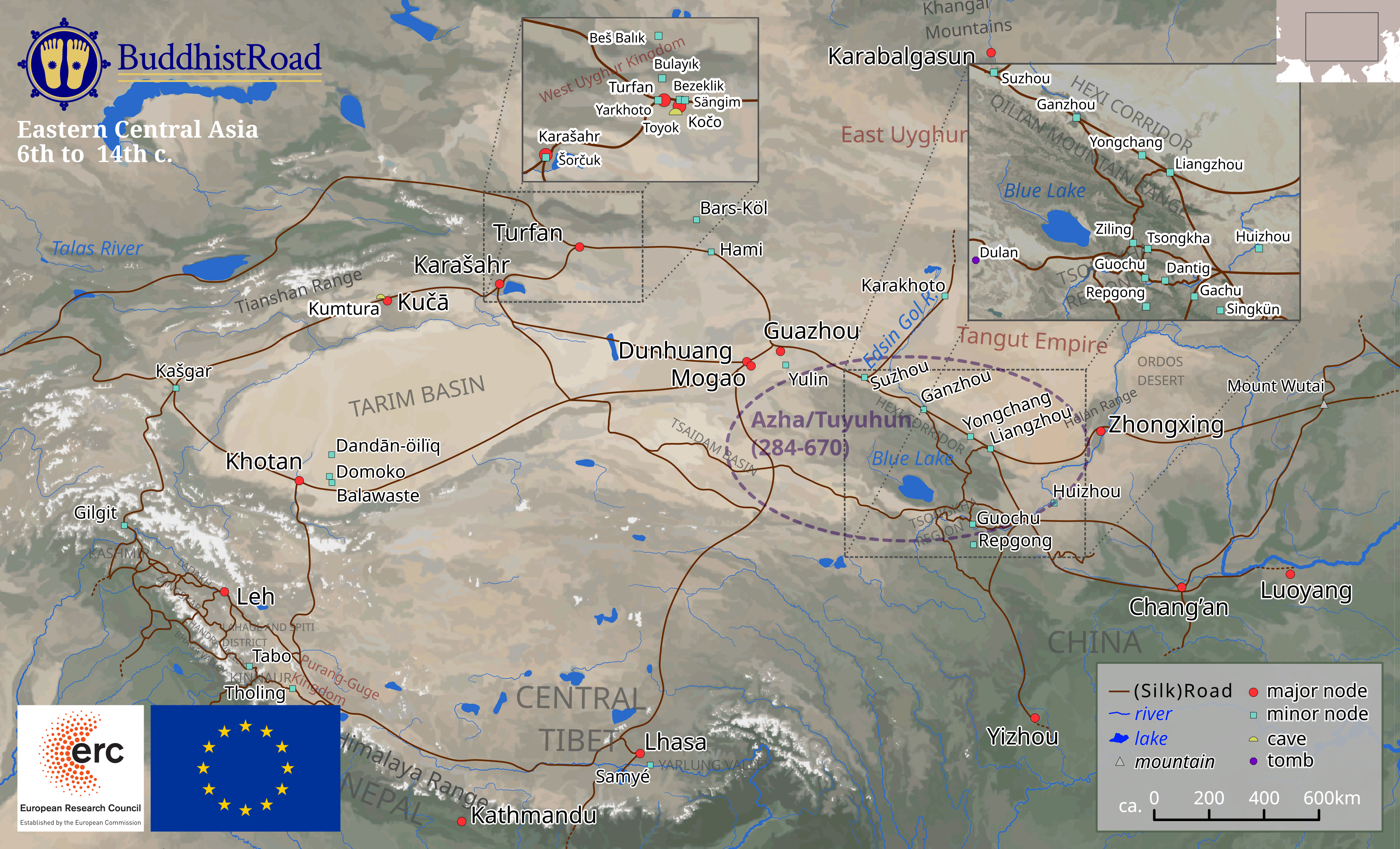
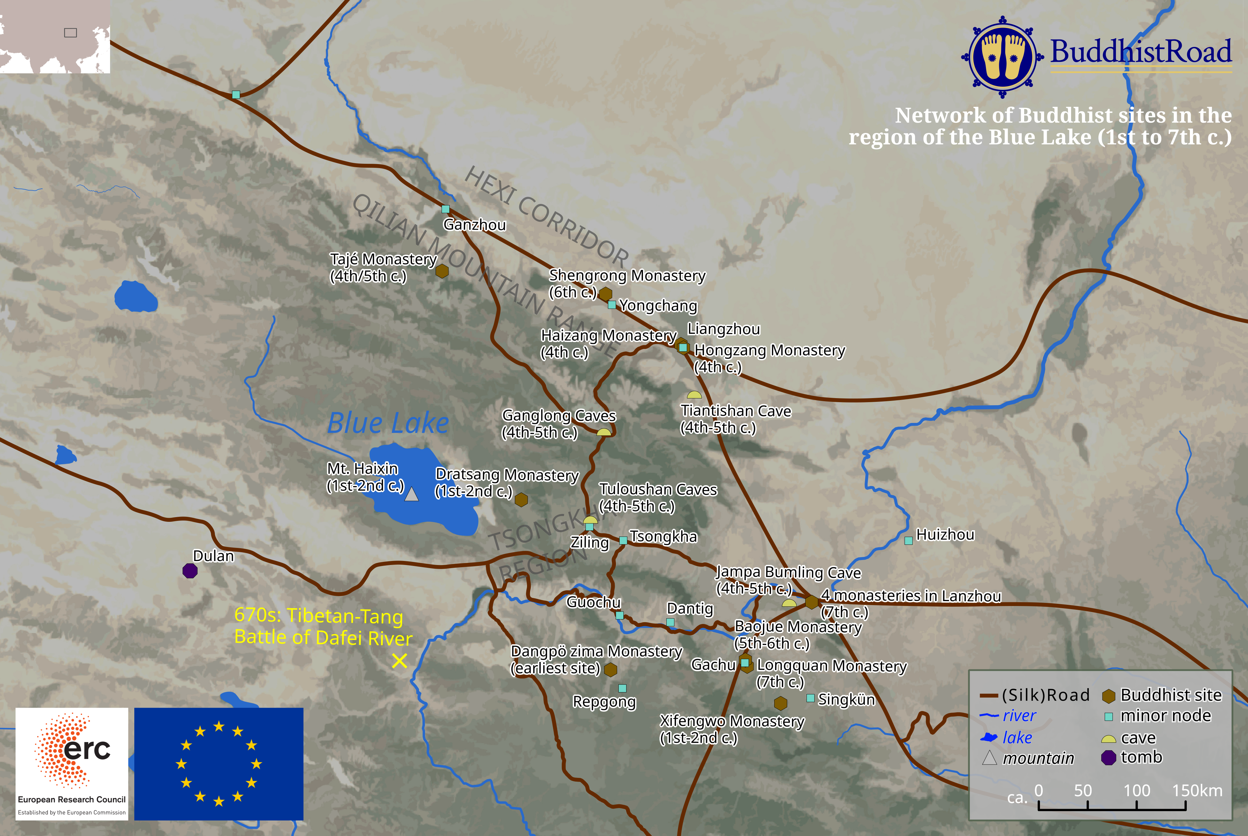
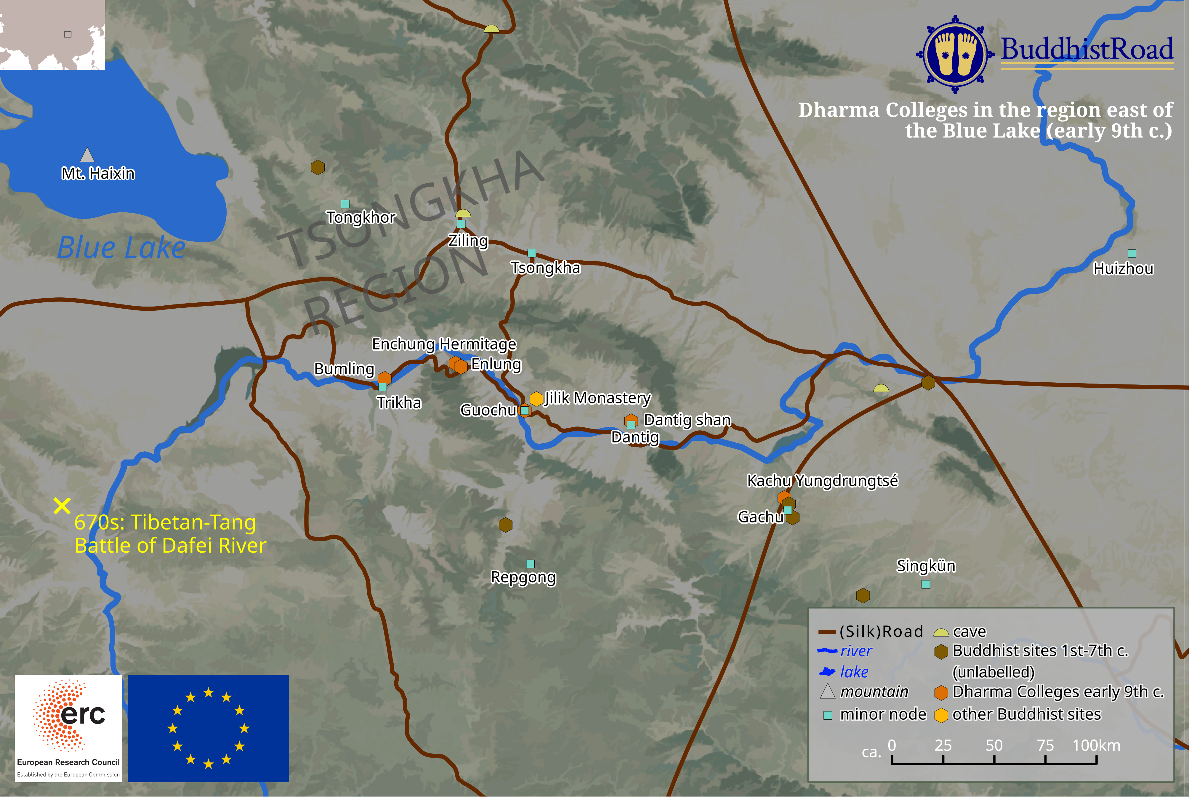
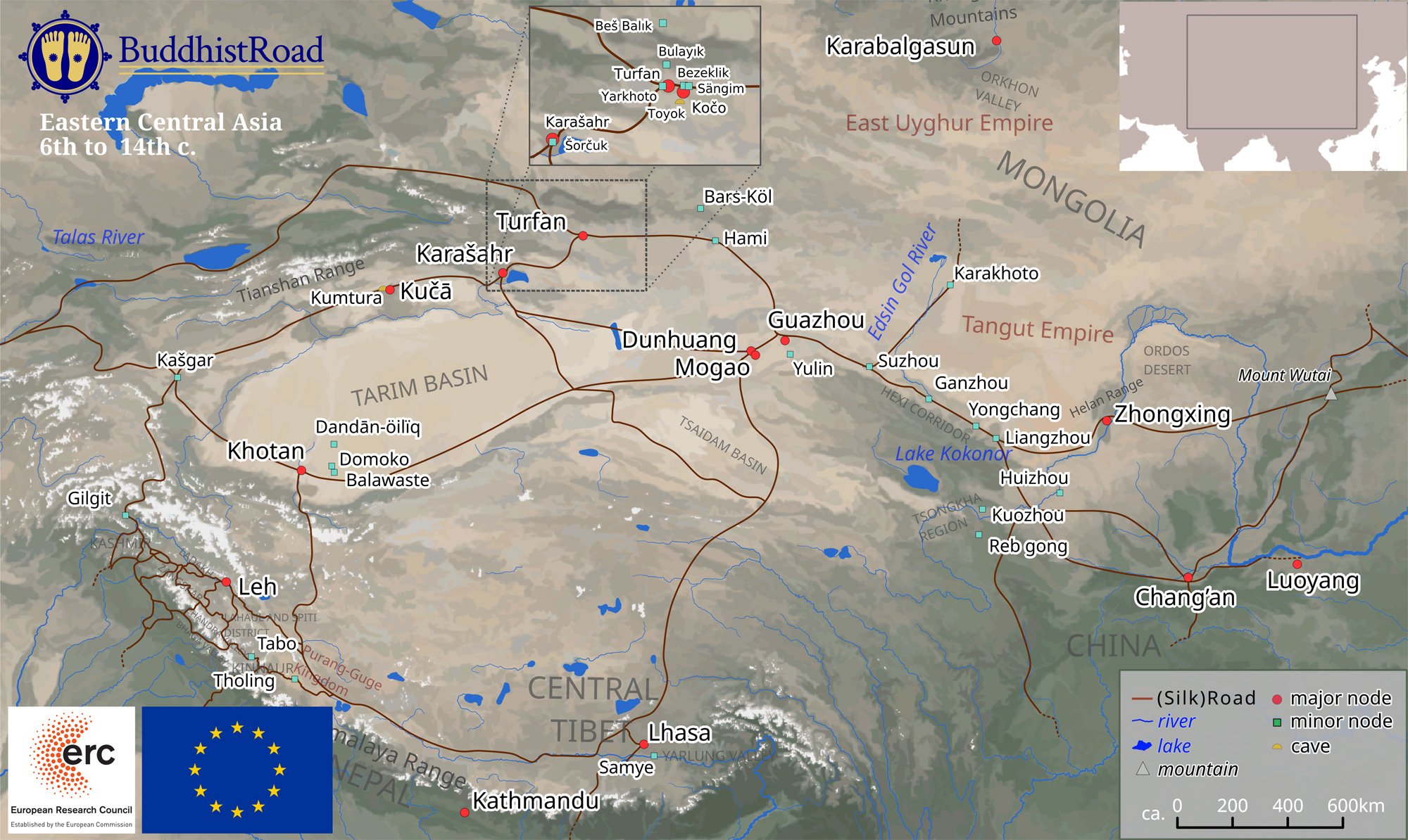
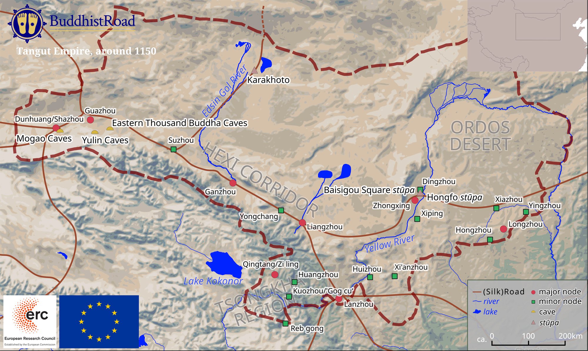
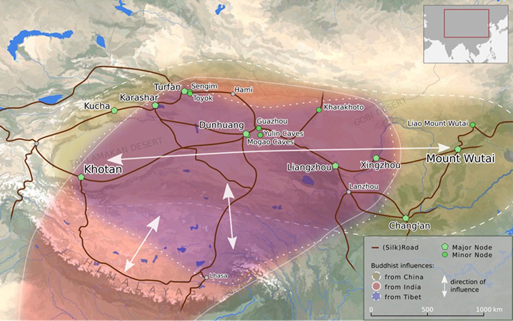
Maps of Central Asia
© ERC BuddhistRoad, 2023. Eastern Central Asia 6th to 14th c. Published in "Buddhism in Central Asia III: Impacts of Non-Buddhist Influences, Doctrines", ed. by Lewis Doney, Carmen Meinert, Henrik H. Sørensen, and Yukiyo Kasai (Leiden: Brill, 2023), 260-261. The map was produced by Jürgen Schörflinger. © ERC BuddhistRoad, 2023. Eastern Central Asia 6th to 14th c. Published in "Buddhism in Central Asia III: Impacts of Non-Buddhist Influences, Doctrines", ed. by Lewis Doney, Carmen Meinert, Henrik H. Sørensen, and Yukiyo Kasai (Leiden: Brill, 2023), 272. The map was produced by Jürgen Schörflinger. © ERC BuddhistRoad, 2023. Eastern Central Asia 6th to 14th c. Published in "Buddhism in Central Asia III: Impacts of Non-Buddhist Influences, Doctrines", ed. by Lewis Doney, Carmen Meinert, Henrik H. Sørensen, and Yukiyo Kasai (Leiden: Brill, 2023), 273. The map was produced by Jürgen Schörflinger. © ERC BuddhistRoad, 2020. Eastern Central Asia 6th to 14th c. Published in "Buddhism in Central Asia I: Patronage, Legitimation, Sacred Space, and Pilgrimage", ed. by Carmen Meinert and Henrik H. Sørensen (Leiden: Brill, 2020), 4. The map was produced by Jürgen Schörflinger. © ERC BuddhistRoad, 2020. Tangut Empire, around 1150. Published in "Buddhism in Central Asia I: Patronage, Legitimation, Sacred Space, and Pilgrimage", ed. by Carmen Meinert and Henrik H. Sørensen (Leiden: Brill, 2020), 253–254. The map was produced by Jürgen Schörflinger. © BuddhistRoad, 2016. The map was produced by Jürgen Schörflinger.